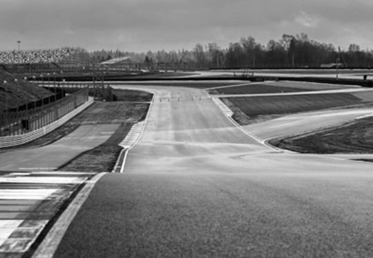
Advances in mobile, laser-based measurement and surveying technologies – the same technologies that are currently informing autonomous road car and ADAS developments – can be used to create remarkably realistic virtual racetracks for gaming applications and simulations. In the case of engineering class Driver-in-the-Loop (DIL) simulators, which are amongst the most demanding applications, LiDAR ( Light Detection And Ranging ) has become the go-to technology for digitally recreating high-resolution roads and tracks.
Digital Assets
Sometimes referred to as simply “laser scanning” or “3D mapping,” LiDAR measures distances by illuminating targets with laser lighting, and it can simultaneously capture the information required to create simulated environments that contain objects for visualization (for human eyes and sensors), as well as road/track surface textures of sufficient fidelity to inform advanced tire models.
As the usefulness of LiDAR data grows, racetracks are getting wise to the notion that LiDAR scans are, in fact, digital assets, valuable ‘fingerprints’ of the track that are compliments to traditional macro-level track maps (elevation and camber surveys, etc.). As such, it has become common for track owners to enter into contractual agreements with scanning companies wherein scans are regarded as intellectual property (IP) and usage rights and fees are defined.
Doubling Down
LiDAR scanning essentially captures two types of information. The first is detailed visual information about a field of view, such as track edges, elevation changes, and trackside objects. A LiDAR scan can be rendered by algorithms and/or graphic artists to provide a photorealistic, geo-identifiable world-scape – graphics that a driving simulator can project or display to inform (and hopefully immerse) a human driver who is participating in a virtual driving experience. The second type of information is macro-quality road surface/texture information with millimeter to centimeter precision. Nowadays LiDAR scans can capture the terrain data that can be served to multi-point contact patch tire models and spectral excitation (thermo-mechanical) models such as TaMeTirE or DT5.
Using LiDAR racetrack scans
The improved accessibility of LiDAR data is good news for motorsports teams and organizations, but careful thought must be given to how the data is gathered, processed, managed and categorized. For example, one might ask the following in order to assess a scanning approach: Do we wish to have LiDAR scans that primarily feed visualizations or engineering simulations? – and one might ask the following in order to assess a data processing approach: Is this a one-off or bespoke situation, or does the data need to be compatible with industry standard file types such as OpenDRIVE® ?
If your race team derives competitive advantage from simulation strategies, the surface/texture data gathered by LiDAR scans can sometimes itself be absorbed into your IP, i.e., the data can become infused, and thus inseparable from, certain tire models. In such cases, diligent database strategies are required to avoid intra-simulation incompatibilities.
It then becomes a question of deciding what level of LiDAR scan complexity is appropriate to present to your tire models. Fundamentally: Are the models satisfactorily “aware” of the road/track surface texture? – and – Is the tire model able to convey that information to the vehicle physics? Team engineers need to decide on an acceptable level of detail – a happy medium that falls somewhere between the two extremes of ‘over-simplified’ and ‘computationally intense.'
In the specific case of DIL simulation, priority might (rightfully) be placed upon real-time execution and the synchronization of world-graphics and road/track engineering data. There are multiple ways to accomplish this, some better than others. One pitfall to surely be avoided is the blurring of the line (no pun intended) between visually rendered road/track textures and the “real” road/track textures than are interacting with your tire models. Some measure of organizational discipline is required to separate church from state, so to speak. For maximum flexibility and scalability, it makes sense, for example, for professional race teams to deploy DIL simulators whose architecture supports the deployment of tire-only or tire-plus-surface models. This leaves all options open – mission critical in the pursuit of competitive advantage.
Do you have a unique motorsports simulation challenge? If so, the following FREE eBook might be a useful reference: